What You Can Build on Your Property in Christchurch (District Plan Guide)
The Quick Answer:
To check what you can build on your property in Christchurch, New Zealand:
- Use the Christchurch District Plan Property Search (GIS map)
- Identify your zoning
- Check for overlays or hazards
- Review built form rules (height, setbacks, coverage)
- Confirm if your project is permitted or needs resource consent
You can also read our other guides in this series:
- Learn how to use the Auckland Unitary Plan and GeoMaps
- Learn how to use the Selwyn and Waimakariri District Plans
- Learn how to use Te Tai o Poutini (West Coast) Plan
Why the Christchurch District Plan Matters
If you’ve ever tried to check what you can build on your property, chances are someone has told you to “look at the District Plan”. It’s the rulebook that determines what is possible on your property.
The Challenge?
The District Plan is detailed and technical—often hundreds of pages long.
The good news is you don’t need to read all of it.
Start with the Christchurch Council GIS Map
The easiest place to begin is the Christchurch District Plan Property Search.
This online GIS map lets you:
- Search your property address
- View zoning and overlays
- Identify site-specific constraints
Think of this as your starting point—it tells you where to look in the District Plan.

Start by typing your address into the ‘search address’ bar (shown above).
Once you find your property, the map will usually show a number of key planning layers that apply to the site. you can click on ‘all layers’ with the button above the map, as well as turning on and off specific layers under the legend shown to the right of the map.
These layers help point you to the parts of the District Plan that are actually relevant to your property and are discussed in a bit more detail below.
Check Your Zoning
Zoning is the single most important factor in determining what you can do with your property.
Common Christchurch zones include:
- Residential Surburban
- Residential Medium Density
- Industrial General
- Central City Mixed Use
Why zoning matters:
Your zone controls:
- Whether you can build a house, units, or commercial space
- What activities you can undertake on that land
- Building height limits
- Site coverage
- Subdivision potential
For Example:
If your site is zoned Residential Suburban, you may be able to build a house as a permitted activity—but adding multiple dwellings may require consent.
Once you know your zone, you can start to understand what the council expects in that area. It also gives you a clearer sense of what you may be able to do on your property and which rules are likely to apply.
Look for Overlays
After zoning, the next thing to check overlays.
Overlays are additional planning layers and may introduce extra rules or constraints.
Common overlays in Christchurch:
- Natural hazard overlays (such as flooding)
- Heritage listings
- Notable trees
- Landscape or coastal protection areas
Important:
Two properties in the same zone can have completely different development potential because of overlays. This is why planners often say that zoning is only part of the story.

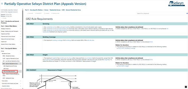
Find the Relevant District Plan Rules
Once you know the zone and overlays, you can go into the Christchurch District Plan and find the rules that apply.
The Christchurch District Plan is structured in a way that groups rules by topic, including:
- Zone chapters with development standards
- Subdivision rules
- Specific overlays or hazards
- Vehicle access and parking requirements
- Earthworks rules (which control how much earth you can move and over what area, and are a common reason why resource consent is required)

The zone chapter is an important place to start as this provides the core activities and Built Form Standards relevant to your property such as:
- Maximum building height
- Boundary setbacks
- Site coverage limits
- Minimum lot sizes (for subdivision)
These rules help determine whether an activity is: permitted, restricted, or requires resource consent. If you think you require consent it is recommended you get in touch so we can help you with this process.

For Example - Can you build another house on your property?
This is one of the most common questions. The answer depends on:
- Your zoning
- Whether overlays apply
- Subdivision rules
- Whether you meet development standards
In many cases you can build another dwelling, but you may need resource consent.
YES, THE DISTRICT PLAN CAN FEEL CONFUSING
Even for planners, District Plans can take time to navigate. Many rules interact with each other, and sometimes the answer to a simple question like “Can I build another house on my section?” depends on a combination of zoning, overlays, and subdivision rules.
The GIS map helps you narrow things down - but it doesn’t tell the full story.
When to speak to a planner
If the rules start to feel a bit too technical, that’s usually the point where speaking with a planner can save you time, uncertainty, and potentially costly mistakes.
Explore our other guides in this series:
- Learn how to use the Auckland Unitary Plan and GeoMaps
- Learn how to use the Selwyn and Waimakariri District Plans
- Learn how to use the Te Tai o Poutini (West Coast) Plan
If you are exploring what you might be able to do on your property and would like planning advice, feel free to get in touch with our team. We’re always happy to have an initial conversation and help you understand the planning framework that applies to your site.
At Inovo, our multidisciplinary team includes planners, surveyors, engineers, and project managers who can support projects from early feasibility through to design, consenting and delivery.
Was this article helpful? Here’s some other topics that might be of interest to you:
National Policy Statement for Natural Hazards (2025): What developers and landowners need to know
What’s the difference between as resource consent and a building consent?
Disclaimer
This article contains general information and opinion based on our expertise. It is provided free of charge and does not constitute legal or other professional advice. The information within it was up to date at the time of publishing.
Have you got further questions about this topic or our other services?
We are always happy to help – drop us an email rmplanning@inovo.nz, or phone us on 020 4000 0294.
.png)